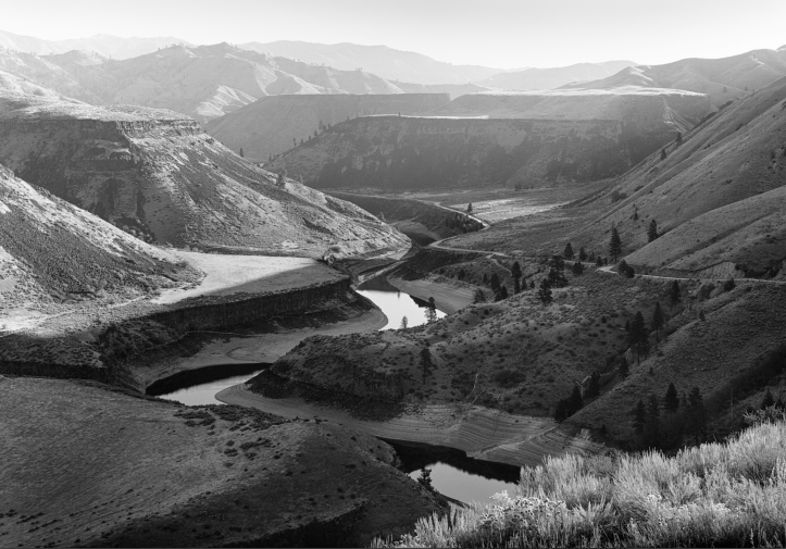
If you’re willing to drive nineteen miles of treacherous road to this viewpoint, you’ve done a lot. The gravel road grinds its way up the wandering and narrow drainage of Blacks Creek, the name the creek shares with the exit on the freeway. You’ll know you’re getting close when you’re about to give up. But if you continue beyond your despair, the road levels and you’re rewarded with this view.
I’ve been interested in the geology of southern Idaho for many years. I learned what I could from the internet, but there were always gaps in my understanding until I met a friendly geologist named Jim Halloran. I sent him a copy of the photo, and he generously labeled it for me.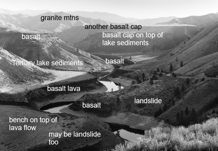
Here’s what I know: ten million years ago, the entire Treasure Valley, from Twin Falls to Baker, Oregon, was a deep lake. It’s commonly understood that Lake Idaho filled until it reached a spillover point near present-day Oxbow, Oregon. The subsequent violent draining of Lake Idaho, which took several hundreds of thousands of years, is what carved the deepest canyon in North America, Hells Canyon.
But before this cataclysmic carve, sediment piled up for millions of years on the lake bed. What we see here are layers of this eroded ancient lake bed and basalt rock from sporadic lava flows that covered the sediment. Like so many sand-filled lava sandwiches.
The South Fork of the Boise River then carved a wandering path through our scene, millions of years in the making. It gracefully forms an “S” curve that leads our eye through this epic scene. Above and behind the sand and basalt stand the granite peaks of the Sawtooth mountain range. Silent observers to this geologic story.
I showed up a few million years later to bear witness with my little wooden camera.
